Climbing Mount Princeton
At the beginning
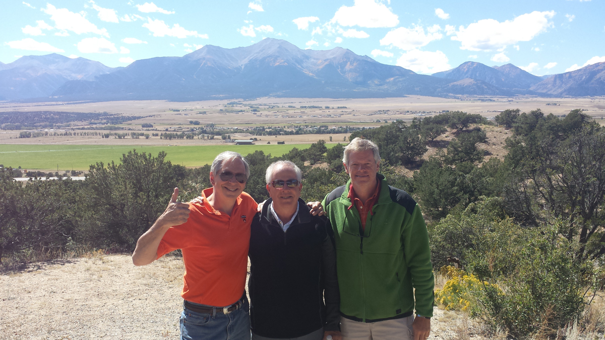
Credit: Petra Swift s76. Princetoniana Museum use only.
Tom Swift, Neil Hauck, and Rob "Ruff" Rider, 76'ers all, meet by chance at a highway scenic view stop on the way to our base camp at the Princeton Hot Springs. Mount Princeton is the highest peak visible in the background.
On the way
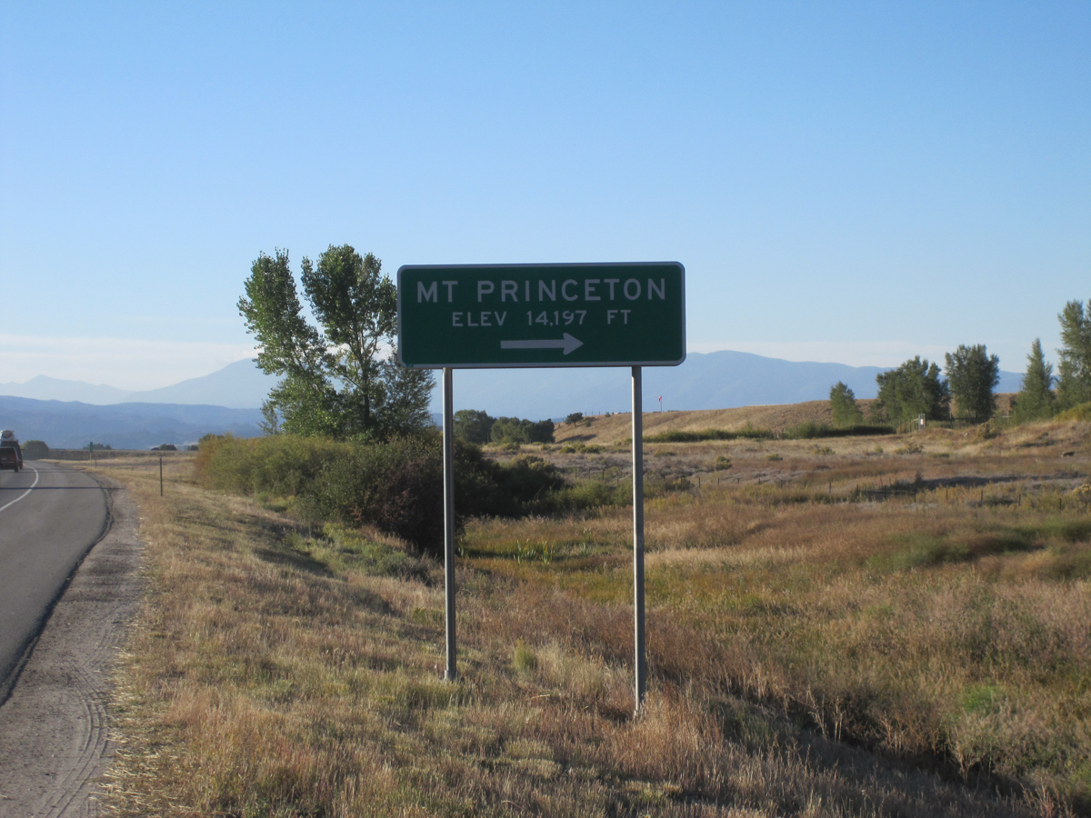
Credit: Thomas M. Swift '76. Princetoniana Museum use only.
On the road approaching our base camp at the Mt. Princeton Hot Springs Resort, located in Nathrop Colorado.
Buena Vista is the largest town in proximity to Mt. Princeton, located southwest of Denver and about 150 miles by car from Denver International Airport. The Mount Princeton Hots Springs resort is south of town at an elevation of 8, 250 feet. About one mile from the resort, at 8,500 feet, is the Mt. Princeton trail-head, as well as the start of a very narrow, very rocky, and very steep dirt road. Using 4x4s we test this approach on Thursday afternoon, taking it to the radio tower site at 10,800 feet, our launch point for the climb. Using the 4x4s will shorten the hike by 6 miles round trip. It is, however, not a drive for the faint hearted.
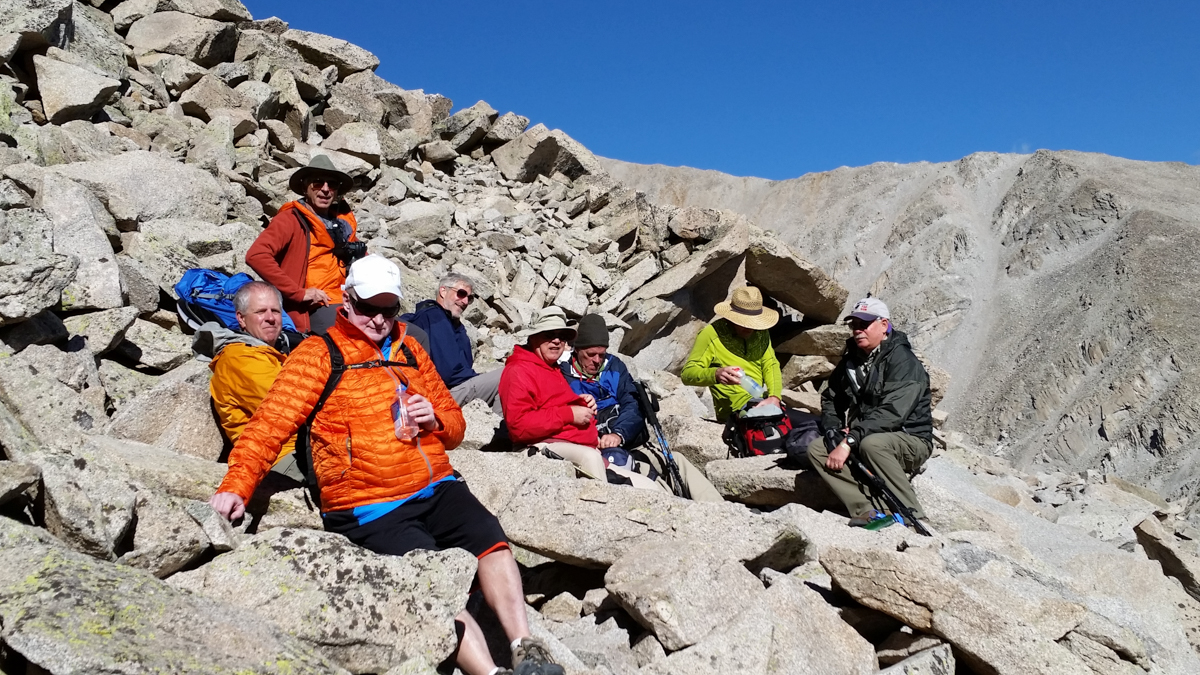
Finalizing the plan
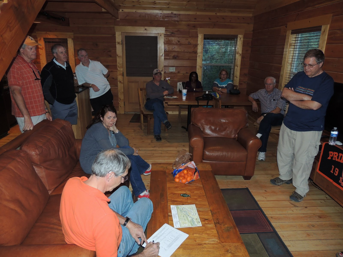
Credit: Thomas M. Swift '76. Princetoniana Museum use only.
In one of cabins at the Hot Springs, final plans are made for the climb.
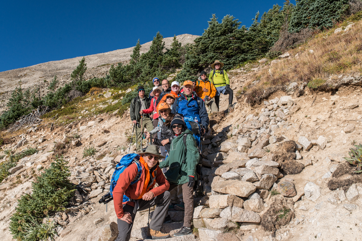
Members of the class of 76 include Tom Bunn, Al Hanson, Neil Hauck, Sandy McCardell, Rob “Ruff” Rider, Jim Russell, and Tom Swift. Others making the climb were John Coventry ’73 s76, Marshall Denkinger ‘81, Caroline Denkinger s81, Chris Godfrey ‘72, and Wanjiku Ndugu. Several non-climber spouses rounded out the group.
Friday September 18th before dawn: The start
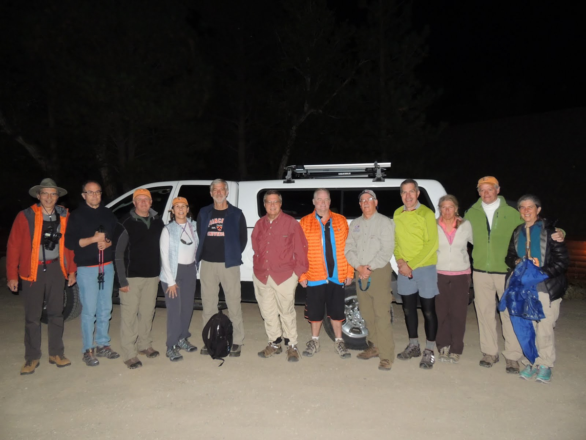
Credit: Thomas M. Swift '76. Princetoniana Museum use only.
Climbers almost ready to begin, after parking the 4x4s at 10,800 feet
We leave the cabins before sunrise, so that the sun will just be coming up when we start out on foot. The drive up the dirt access road seems less intimidating this morning, either because of enthusiasm or more likely because we can't see how bad it truly is. The temperature is in the 30s but the forecast is for increasing temperatures and no snow or thunderstorms.
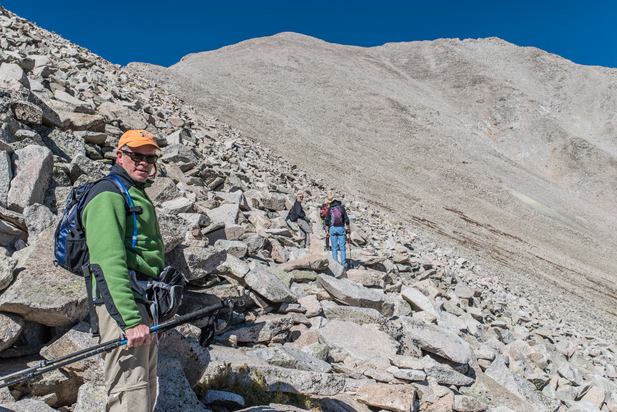
An easy hike up the road
Credit: Thomas M. Swift '76. Princetoniana Museum use only.
We continue up the road on foot at an enjoyable if somewhat leisurely pace. Afternoon thunderstorms remain a possibility even in mid September, and being on or close to the ridge during lightning strikes is dangerous. Our plan is that we will turn back at noon, whether or not we have made the summit.
The end of the road
Credit: Thomas M. Swift '76. Princetoniana Museum use only.
At 11,800 feet, the trail to the summit turns off the road. The landscape continues to change, and at this point we are close to treeline.
With oxygen becoming a bit scarce, we pause for a short rest and a photo op.
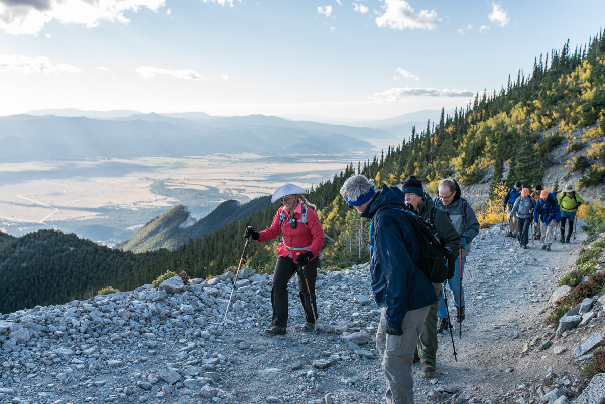
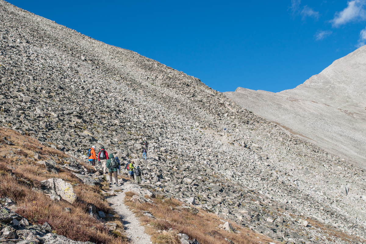
The trail narrows and the view widens
Credit: Thomas M. Swift '76. Princetoniana Museum use only.
Now above treeline, the terrain becomes barren.
In the span of 20 minutes since we left the road, the landscape has become devoid of trees and the trail has become narrow. We become aware that a slip could potentially result in a very long roll downhill. However, the views looking towards the valley are - particularly for flatlanders from New Jersey - utterly spectacular, and we press on.
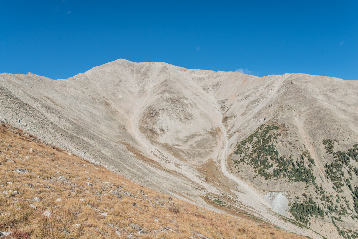
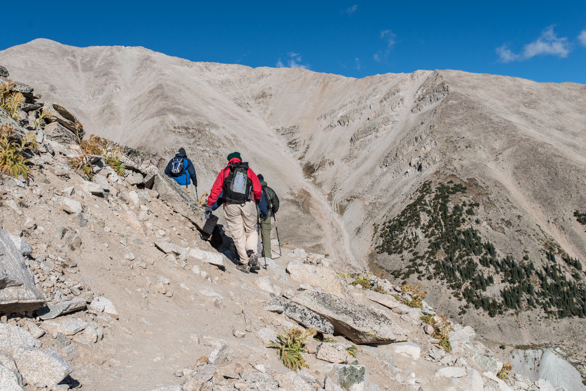
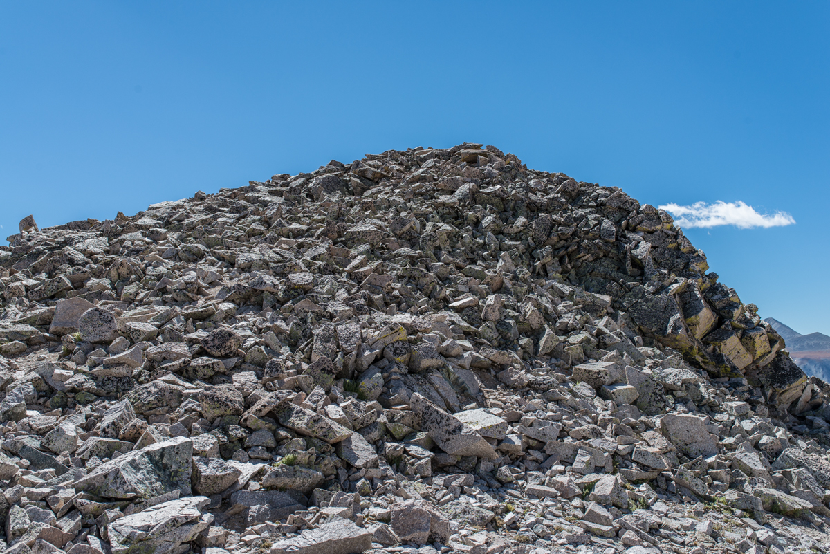
The challenge becomes clearer
Credit: Thomas M. Swift '76. Princetoniana Museum use only.
For those unaccustomed to mountaineering, the site of what lies ahead is astonishing. The summit of Mt. Princeton is the peak at left center.
Our task is to get on top of the ridge line at left and follow it up to the summit. Below the ridge, any storms coming in from the west will be invisible until upon us. The accuracy of a weather forecast takes on a different meaning if your survival depends on it.
Trail? I can't see a trail
Credit: Thomas M. Swift '76. Princetoniana Museum use only.
The path is blocked by broken rock fragments called scree.
Prior to the climb, we read about scree. We are now upon it. And it does not leave a welcoming impression. If there is indeed a trail, it is very hard to discern from this vantage point.
This is the trail? Seriously?
Credit: Thomas M. Swift '76. Princetoniana Museum use only.
A trail that does not in any way resemble those through the Institute Woods.
The trail through the scree is the pedestrian equivalent of the access road: very narrow, very rocky, and always at an angle to horizontal - sometimes impressively so. For geezer climbers, intense concentraion on footwork is required, since one wrong step could bring a sprained ankle, or worse.
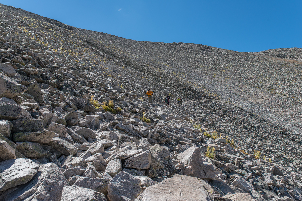
A drop of orange in a vast sea of grey
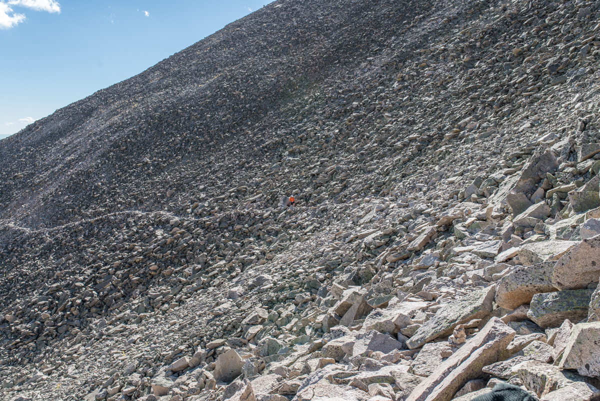
Credit: Thomas M. Swift '76. Princetoniana Museum use only.
The group shrinks and spreads out.
At 930 am, the climb has begun to take a physical toll. A combination of altitude and difficult footing cause several team members to head back towards the 4x4s. Others press ahead, but everyone is aware of the challenge.
Step by step
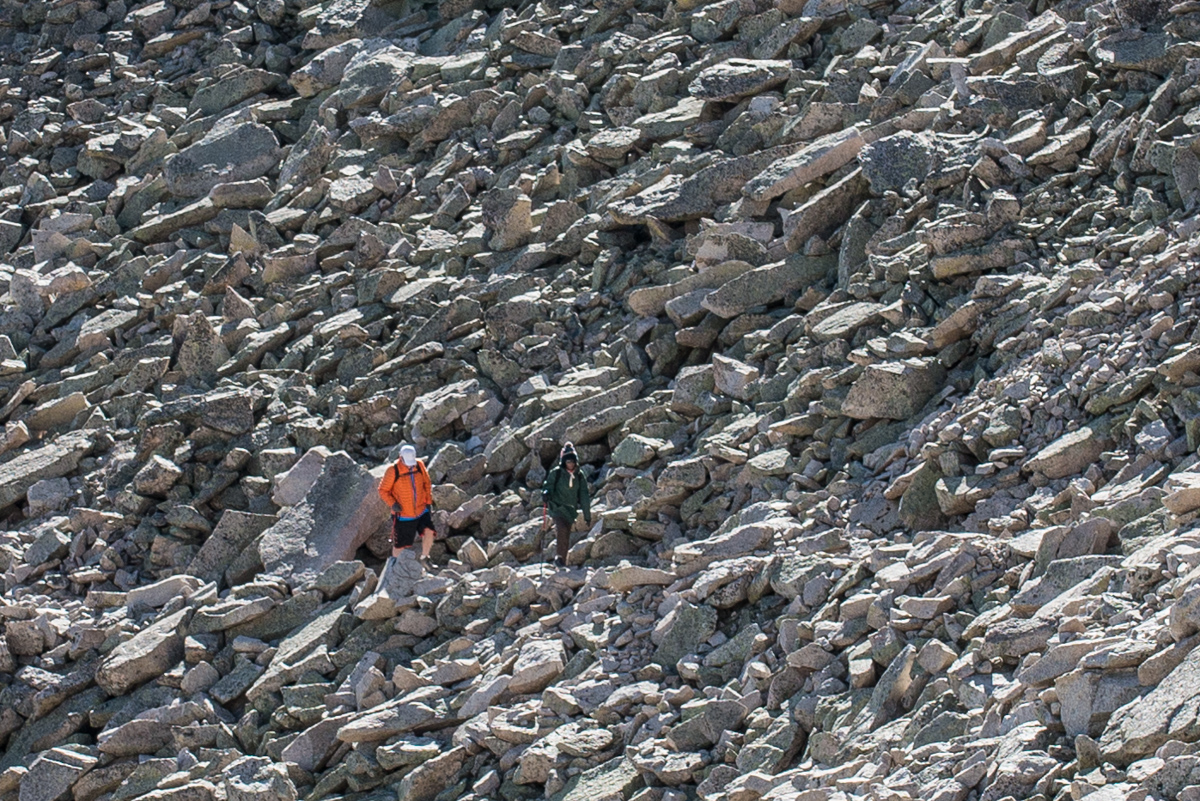
Credit: Thomas M. Swift '76. Princetoniana Museum use only.
High resolution photography enables a closer view of Al Hanson and friend Wanjiku as they navigate the alien terrain.
One 76er insisted on bringing his high resolution - and very heavy - camera, along with a tripod. By this point, he was beginning to regret that decision.
Are we there yet?
Credit: Thomas M. Swift '76. Princetoniana Museum use only.
We take a rest and prepare for more.
Marshall Deckinger '81 is an emergency room physician who practices not far from Mt. Princeton. Months before the trip, he was coaching us on what to expect, and how to train for the climb. He and his wife Caroline showed up for the climb with a 4x4 complete with an oxygen cylinder in case someone should suffer from altitude sickness. During our rest he measured blood oxygen levels. Shortly thereafter, one of our climbers felt ill, and Marshall took him under his care and escorted him back to the 4x4s. For his service to the class of '76, Marshall was made an honorary member.
We follow the "old" trail
Credit: Thomas M. Swift '76. Princetoniana Museum use only.
We choose to follow the "old" trail, which goes straight, rather than turn left at the sign to follow the "new" trail up to the ridge.
In retrospect, this was a mistake
Credit: Thomas M. Swift '76. Princetoniana Museum use only.
The "old" trail disappears and we are left scrambling over scree.
It soon became clear that we were no longer on a trail. The hiking became very difficult as we struggled to make progress on the precarious footing of the scree, several hundred feet below the ridge line.
Preparing for the scramble to the ridge line
Credit: Thomas M. Swift '76. Princetoniana Museum use only.
Neil Hauck gets ready to to scramble up to the ridge
At this point we knew that we could not continue unless we got back on the path, which by this point was on the ridge line.
The immediate challenge
Credit: Thomas M. Swift '76. Princetoniana Museum use only.
The route to the ridge
The climb to the ridge was very steep and completely on loose rock, making it difficult to maintain solid footing and good balance. It was a very hard effort to gain a couple of hundred feet.
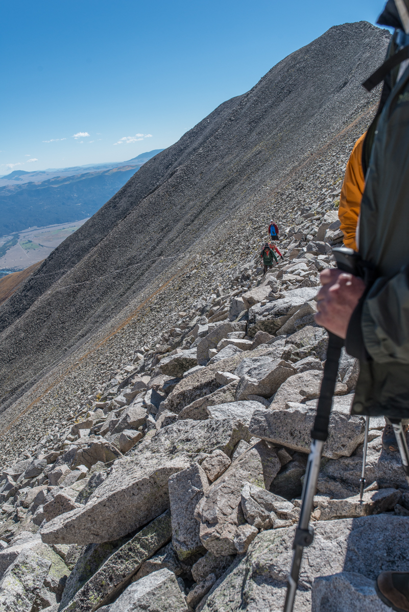
The trail on the ridge
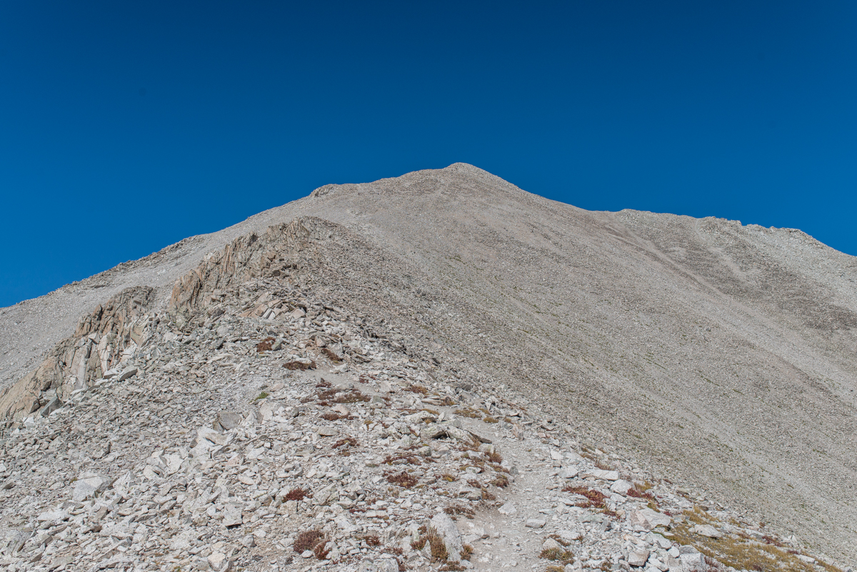
Credit: Thomas M. Swift '76. Princetoniana Museum use only.
We finally make it to the ridge.
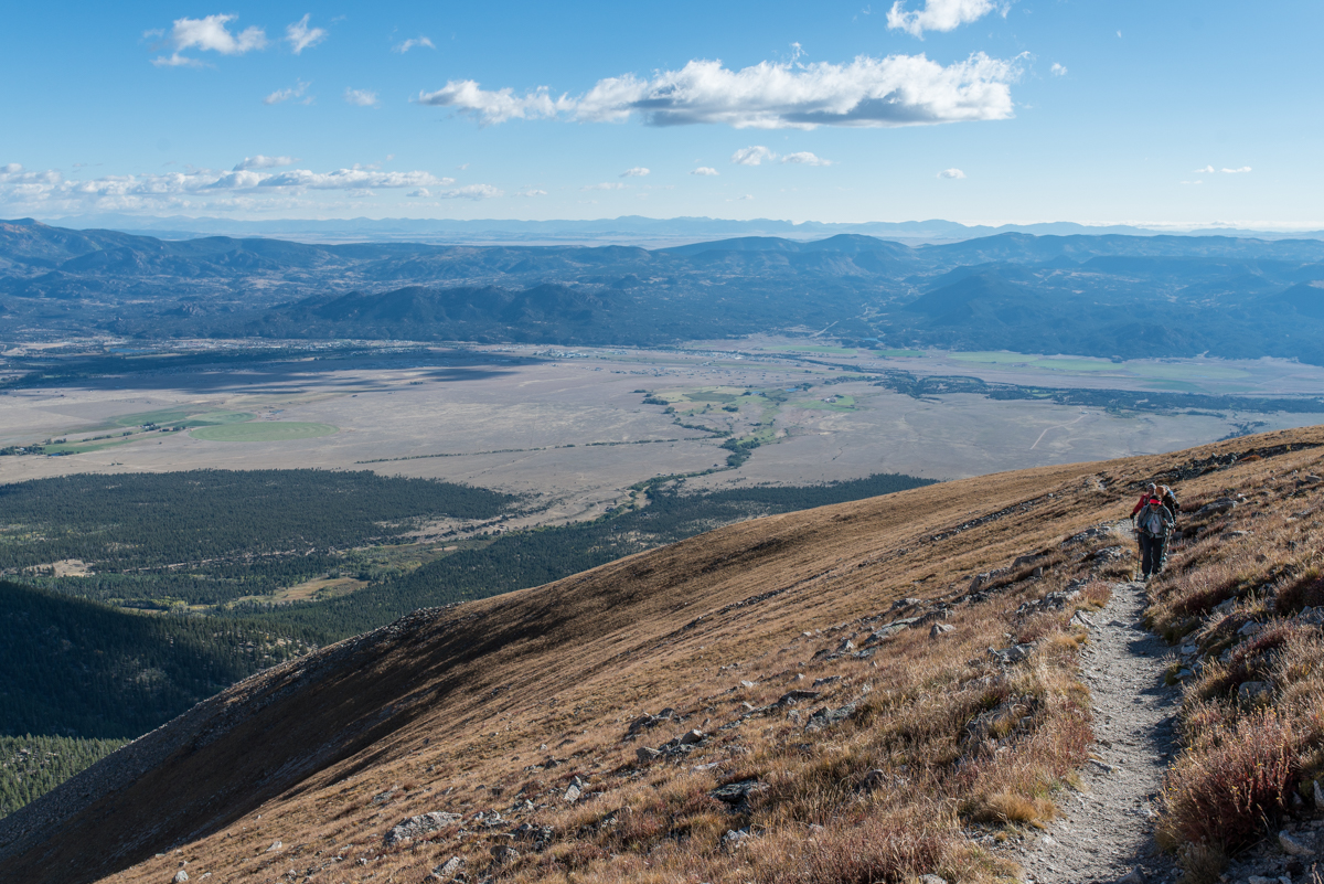
At this point we are at roughly 13,000 feet. The good news is that we can now look west, and the sky is clear - no chance of thunderstorms. The bad news is that there are wind gusts up to about 40 MPH. Although hiking along the ridge is much easier, we still have 1000 feet to climb, and we are running out of time.
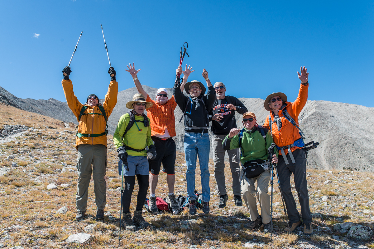
We declare victory
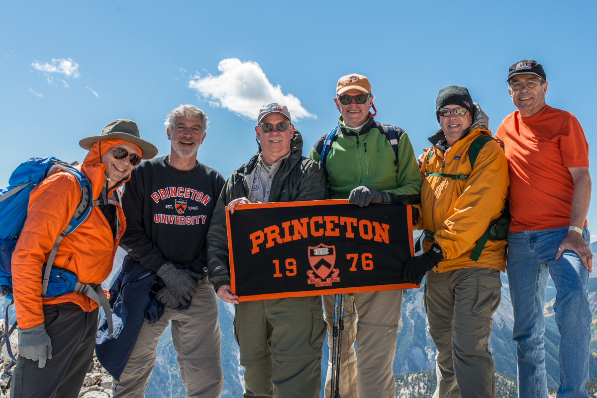
Credit: Thomas M. Swift '76. Princetoniana Museum use only.
We stand on the ridge at 13,400, the high point of our journey.
After our off-trail excursion and the scramble to the ridge, hiking along the ridge is a relief. However, we had agreed that we would start our descent at noon "no matter what." It is now almost 1 pm, and we are about 700 feet shy of the summit. All are tired, some are exhausted. We hold a meeting and decide to display the banner then turn back.
The "new" trail
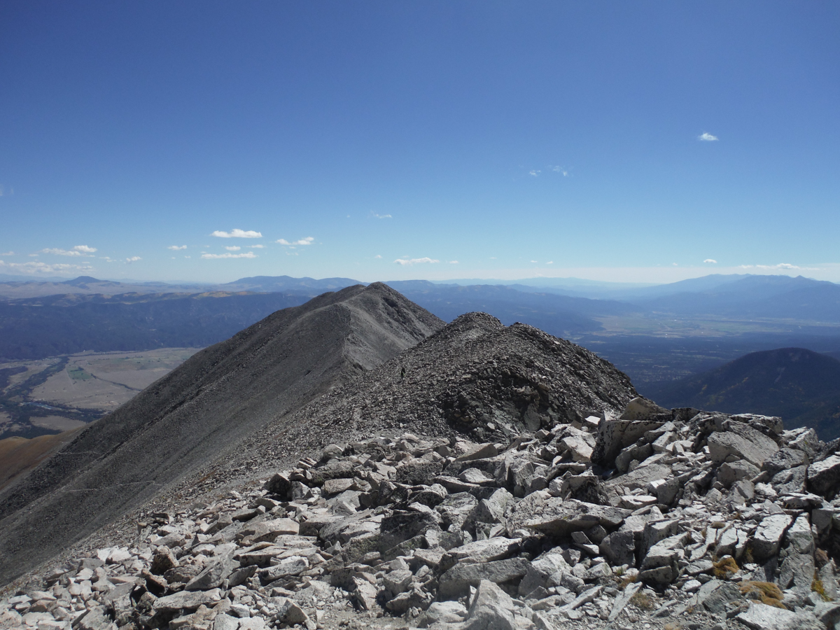
Credit: Thomas M. Swift '76. Princetoniana Museum use only.
We start the descent, following the ridge line.
Inexperienced hikers assume that descent is easier than ascent. True in the sense of having gravity work in your favor. False in terms of muscles and tendons, that now have to function as brakes. Very, very fatigued brakes. We have hours of descent ahead of us.
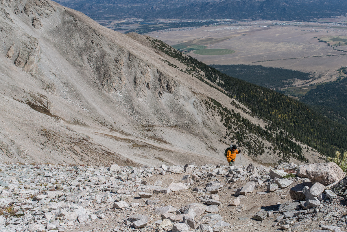
Pushing our limits
Credit: Thomas M. Swift '76. Princetoniana Museum use only.
Team members approaching the end of the scree, running on near empty
We follow the "new" trail along the ridge and then turn off the ridge at a sign. This path down is more of a trail, less steep and rocky than our ugly off trail route up. We rejoin the trail we came in on, and continue to descend. Everyone is tired and taking great care not to put a foot wrong.
In celebration of firm footing
Credit: Thomas M. Swift '76. Princetoniana Museum use only.
Finally off the scree!
Somehow the group finds the energy to celebrate our return to terra firma. We proceed with reduced vigor onto the road and to the 4x4s, where we are greeted by the rest of the team. We make it back to the Hot Springs by 4 pm. We find out later that class officers and friends were monitoring our progress via GPS tracking. Nothing escapes our wonderful Class President Rosalie Norair.
The fest
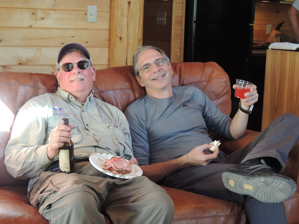
Credit: Thomas M. Swift '76. Princetoniana Museum use only.
Rarely have sandwiches and beer been so well received.
Our support crew, Rick Held, Carole Russell, and Petra Swift, did a fine job of feeding the exhausted and the famished.
Lounge chair heaven
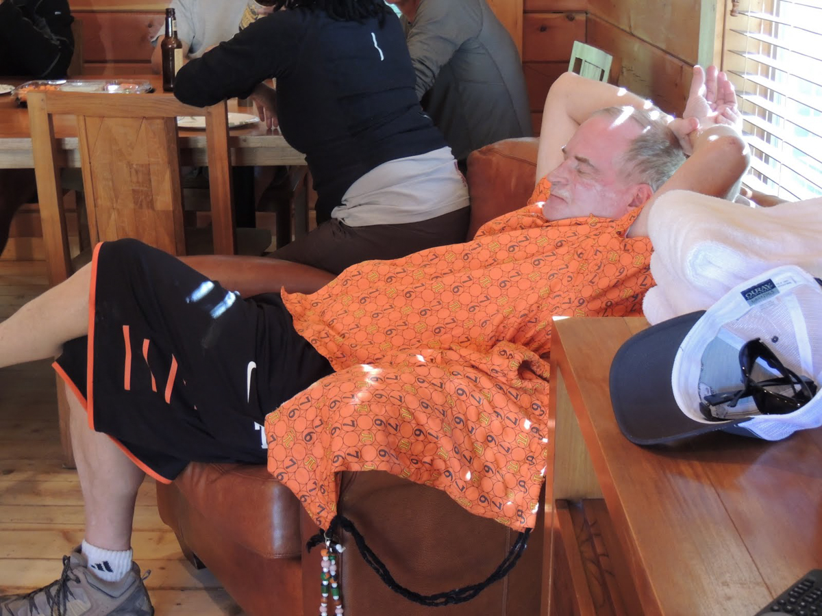
Credit: Thomas M. Swift '76. Princetoniana Museum use only.
Al Hanson takes a well deserved rest.
For aging Princetonians, the climb up Mt. Princeton was many things. A chance to renew old friendships and forge new ones. The demonstration of school and class spirit in the run-up to a major reunion. The opportunity to be a part of a team doing something way out of our comfort zones and way beyond what many thought were their physical limits. At our 40th reunion the following May, Al Hanson was talking about organizing another climb. To that point, what is that Japanese proverb about the wise man climbing Mt. Fuji only once?
-Tom Swift '76
The Great Class of 1976 decided to undertake a climb of Mount Princeton, Colorado, as part of the run-up to our 40th reunion. It was decided that the best time to do this was at the end of summer in September 2015. At this time of year, mountain weather is least susceptible to storms: either thunderstorms or snowstorms. Most of the climbers arrived in Colorado a day or two beforehand, in order to acclimate to the high altitude and thus reduce the chance of experiencing altitude sickness during the climb.